
What has changed — and what has not
The detailed proposals on this page were developed over several years, particularly from 2019 to 2022. Some parts have since moved forward; others remain unresolved. Rather than erase that history, this page shows how the original proposals connect to today's priorities.
20mph across most of Woodstock
The campaign for lower speeds has moved from proposal to reality across most of the built-up area. That changes the context, but not the need for safer crossings and protected routes.
Northern A44 30mph extension
The 30mph limit on Manor Road has been extended northwards beyond Hill Rise, addressing one of the long-standing requests linked to development at the northern edge of town.
Formal crossing near Hill Rise
The current Woodstock Area Local Cycling and Walking Infrastructure Plan still identifies a formal crossing point in the vicinity of Hill Rise.
Protected route towards Wootton
The current LCWIP also retains a long-term ambition for an off-road cycle route along the A44 corridor towards Wootton, alongside shorter-term improvements.
Why this work started
The A44 is not simply a road through Woodstock. It is also Manor Road, Oxford Street and the route people living in Old Woodstock have to use to reach schools, shops, the surgery, bus stops and the town centre. In several places the road geometry leaves very little margin for people outside a vehicle.
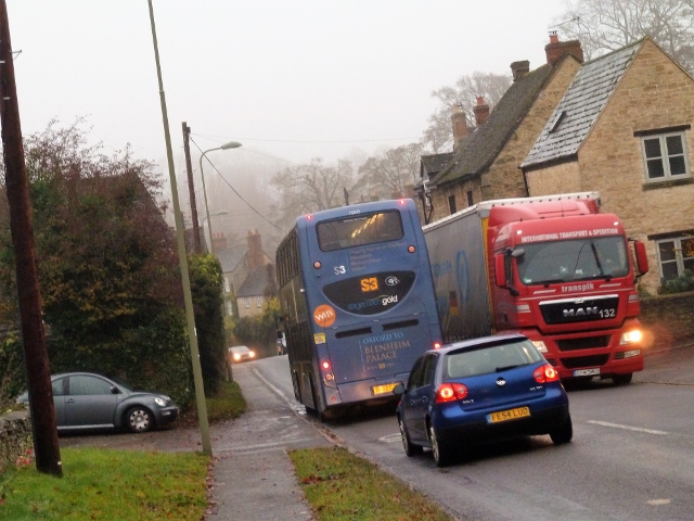
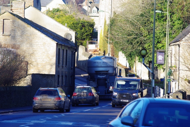
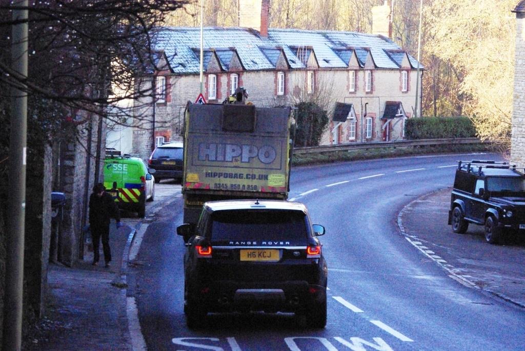
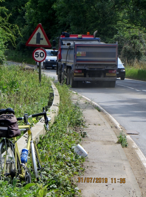
The campaign submissions recorded some particularly difficult conditions on the A44: carriageway width down to about 5.5 metres in places; footways below 0.75 metres; buildings immediately behind the pavement; blind bends; and a gradient of roughly 1:12 on parts of the route. The concern was not just collision history, but the daily experience of people walking beside heavy, fast-moving traffic.
For Old Woodstock, the central problem was simple: there was no comparable alternative route to the schools and town centre. If a route feels intimidating for a child, an older resident or someone pushing a buggy, the existence of a pavement alone does not make the journey genuinely accessible.
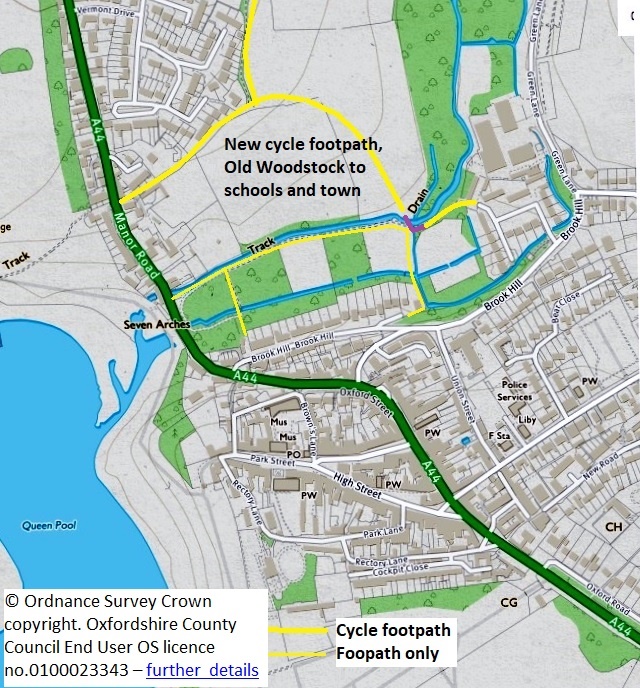
Old Woodstock → town centre and schools
This is the most developed part of the original work. The 2019 proposal did not rely on a single line on a map: it set out three possible off-highway connections, each serving a slightly different journey.
The watermeadows question
The route through the watermeadows became a genuine local planning disagreement. Woodstock Town Council rejected the proposed path across the meadows in 2020 because of concern about urbanising a tranquil and ecologically valuable space. Importantly, the Council also acknowledged that safe access from the Hill Rise development into the town and schools was necessary, and suggested an alternative route using Blenheim land behind Hill Rise, crossing the Glyme farther upstream and connecting towards Green Lane.
That distinction still matters. The unresolved question is not whether Old Woodstock needs a safer connection; it is which alignment can deliver a useful, accessible route while respecting the watermeadows and their ecology.
Where the current LCWIP picks this up
The current Woodstock Area LCWIP identifies a formal crossing point near Hill Rise and a series of walking improvements around Glyme Close, Brook Hill, Green Lane and the nature-reserve connections. It therefore carries forward several of the ingredients needed for a coherent Old Woodstock route, even though it does not simply reproduce one of the original alignments.
The traffic-management package
The safer-routes work was never based on paths alone. The original proposals treated speed limits, crossings, cycle parking and junction design as part of the same network. A protected route that ends at an unsafe crossing is not a complete route.
Introduce a 20mph limit on the A44 through the town centre, originally suggested from around Caroline Court to at least Lower Brook Hill, with the exact extent open to discussion. Much of the wider 20mph ambition has since been delivered.
Reduce speeds on the A44 between Bladon Roundabout and the built-up area, while widening and improving the existing walking/cycling provision towards Bladon Chain and making the roundabout easier to cross safely.
Extend the lower speed limit north of Hill Rise to cover the development access and create a safer transition towards the first Wootton turn. The 30mph extension has since been approved and implemented.
Add more convenient cycle stands in the centre, with locations agreed with the Town Council so cycling is practical for short everyday trips as well as through-journeys.
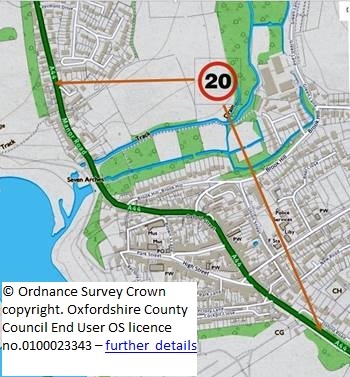
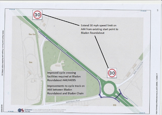
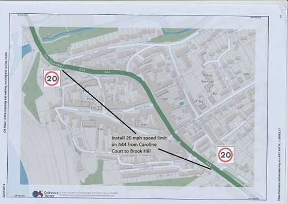
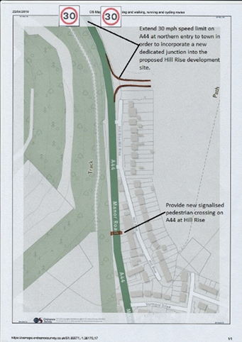
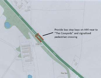
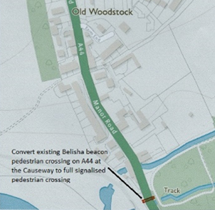
Three crossing locations identified in the original work
A crossing on the A44 intended to work with bus-stop and bus-bay provision serving the Park View development at Woodstock South-East.
Upgrade the existing beacon crossing to a full signal-controlled pedestrian crossing, making the main east–west movement across the A44 more dependable.
A new formal crossing to connect Old Woodstock and future development to traffic-free routes. This remains recognisable in the current LCWIP, which calls for a formal crossing in the vicinity.
Woodstock → Wootton and the B4437
The northern connection was deliberately explored as a set of alternatives rather than a single predetermined scheme. The objective was a safe route from Hill Rise towards Wootton, the B4437/Judds Garage junction, Stonesfield and Charlbury.
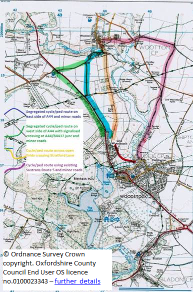
The school journey was a major part of the argument. Wootton Primary School draws pupils from the Old Woodstock catchment, while secondary-school journeys run the other way towards Marlborough School. A route that works for children and families therefore creates a useful everyday link in both directions.
How the current LCWIP develops the idea
- Short term: a cycle path along the A44/Hollyhock Walk past Field Barns, with signage and maintenance.
- Long term: an off-road cycle path along the A44 corridor from the Duke of Marlborough junction into Woodstock, in the field beside the road.
- Into Wootton: assess a footpath connection from the A44 junction through West End, segregated from the A44 where possible.
- At the first Wootton turn: consider traffic islands and a safe crossing point/refuge arrangement.
This is a useful evolution of the original route study: the exact geometry has moved on, but the case for a protected Woodstock–Wootton connection remains embedded in the area's strategic walking and cycling plan.
Bladon → Hanborough station
The original safer-routes programme also looked south and west. One of its four core projects was upgrading the existing pedestrian route between Bladon and Hanborough railway station so it could work better for both walking and cycling.
The 2019 proposal anticipated that part of the connection might need a short off-highway section on Blenheim land. It also linked the route to traffic management through the narrow A4095 in Bladon, including a lower speed limit, because the quality of the inter-village path is only one part of the journey.
Today, this wider inter-village work is mainly taken forward through the Villages Travel Network and the Woodstock Area LCWIP, which cover Woodstock, Bladon, Hanborough, Combe, Stonesfield, Wootton and Blenheim as one connected travel area.
Questions the campaign had to answer
Some apparently simple road-safety solutions have difficult trade-offs. The original project produced an FAQ to explain why.
Why not simply ban HGVs from the A44?
A weight restriction would need numerous exemptions for local deliveries, building work, farming, buses, refuse collection and emergency access. It could also divert through-HGV traffic onto other unsuitable routes. That does not mean HGV impacts should be ignored; it means a weight limit is not a simple substitute for safer street design.
Why was a one-way system through the Hensington Road narrows treated cautiously?
Removing opposing traffic can make a narrow road feel easier to drive quickly. The original FAQ therefore argued that any one-way arrangement would need to be considered alongside additional traffic calming on Hensington Road and Union Street.
What happened to the argument for 20mph?
The context has changed substantially. The original submissions spent considerable effort arguing that a lower limit was proportionate and achievable. Most of Woodstock is now covered by 20mph restrictions, so the live question has shifted towards route quality, crossings, compliance and the remaining higher-speed approaches.
Original maps and source documents
The detail matters, so the underlying submissions are kept here rather than hidden behind a summary. These local copies mean the material remains available when the old website is retired.
Historic maps reproduce Ordnance Survey mapping under the licence and copyright notices contained in the original Sustainable Woodstock documents. The route drawings represent proposals at the time they were produced, not surveyed construction drawings.